The bays and wetlands around the American coastline are constantly changing. Some of the changes are natural, but some are caused by people. A network of instruments around the country is helping scientists understand these changes, while providing critical information to those who help manage coastal development.
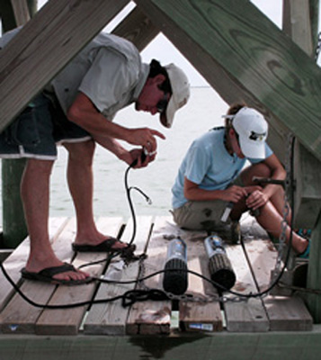 Researchers working with data collection instruments. Credit: Mission-Aransas National Estuarine Research Reserve.
The instruments are part of a project called SWMP — the System-Wide Monitoring Program. It’s being conducted at National Estuarine Research Reserves — about 30 locations around the country that are being studied by collaborations between the federal government and coastal states.
Each SWMP location uses identical sets of instruments to study water quality, nutrients, weather, the concentration of microscopic organisms, and much more. The instruments transmit their readings to researchers every 15 or 30 minutes, where they’re recorded for analysis. That allows scientists to study changes in the reserves from day to day, season to season, and year to year.
The Mission-Aransas reserve in Texas has five sets of instruments scattered through its 300 square miles. They’re in open bays, near the mouths of rivers, and at the shore of the Gulf of Mexico. In their first five years of operation, they’ve shown that the estuary system is fairly healthy — it isn’t being overly fouled by pollution or by fertilizer-rich runoff from farms and ranches.
These and the SWMP findings in other reserves can help planners try to manage the ongoing changes along our fragile coastlines.
