Louisiana is disappearing. Over the last century, it’s lost about 2,000 square miles of its beaches and coastal wetlands -- an area as big as Delaware. Today, the loss averages about 25 square miles a year -- although in some years it’s much more. In 2005, hurricanes Katrina and Rita washed away more than 200 square miles in just a few days.
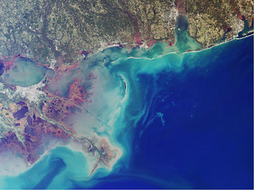 Veiw of a portion of the Louisiana coast line. Credit: National Oceanic and Atmospheric Administration.
That’s not just a problem for mapmakers. The loss destroys habitat for fish, birds, and other wildlife. It damages tourism and other businesses. And it makes the coast more vulnerable to big storms, costing lives.
Most of the loss is the result of efforts to tame the Mississippi River. After a devastating flood in 1927, the federal government built levees to protect New Orleans and other towns. But the flooding was crucial to the wetlands along the coast. In part, that’s because the land near the coast sinks as sand and clay settle. The floods brought fresh sediment that rebuilt the land.
Another problem is the canals that have been dredged through the wetlands for oil and gas exploration and production. The dredging destroyed vegetation, while the canals allowed saltwater to move inland, destroying more of the marshes.
Logging in the 1930s destroyed vast forests, and pollution and agricultural runoff damaged the wetlands even more.
Louisiana still accounts for about a third of all the coastal wetlands in the Lower 48 states. But without some help that fraction will continue to dwindle -- as Louisiana slowly disappears into the sea.
