hurricane.jpg
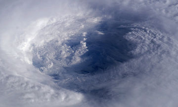
Hurricane gliders measure ocean conditions before, during, and after hurricanes. Photo Credit: NASA
Hanging out in the water while a hurricane is bearing down sounds a little scary. But that’s just what some underwater “gliders” are doing. They’re recording ocean conditions before, during, and after hurricanes pass overhead. That’s helping scientists improve their forecasts of hurricane intensity.
The gliders look like torpedoes with wings -- long metal cylinders packed with instruments. They monitor ocean temperature, salinity, and other parameters. They can dive hundreds of feet down. And they occasionally pop to the surface to transmit their readings via satellite -- and to get instructions from home.
Over the last few years, several gliders have been deployed during hurricane season. They’re stationed along likely hurricane paths, and can stay there for months. When a hurricane is approaching, they measure conditions in the water ahead of it. Forecasters can crank those numbers into their models of how hurricanes behave.
Results from the gliders have been promising. They’ve shown that understanding what’s happening in the top layers of the ocean in front of a storm improves the accuracy of hurricane forecasts -- especially forecasts of intensity.
The gliders also watch what happens to the ocean as a hurricane passes across it. They measure how the ocean cools, and how the layers of water are churned up. And they measure how quickly the ocean returns to its pre-storm condition. Those observations, too, should help improve our understanding of these killer storms.
